Choquequirao
Choquequirao, meaning cradle of gold in Quechua, is a huge ruin of an ancient Inca city. It’s expansive and impressively well preserved. It sits on the brink of the Apurimac Canyon and began to gain interest for international travelers after being crowned in Lonely Planet’s Best in Travel 2017. However, it has been well known in Peru for a long time before this.
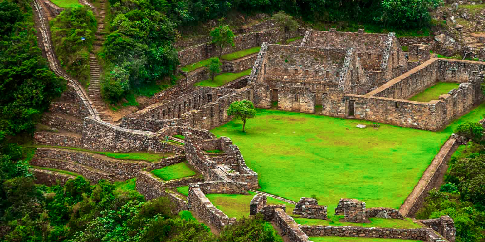
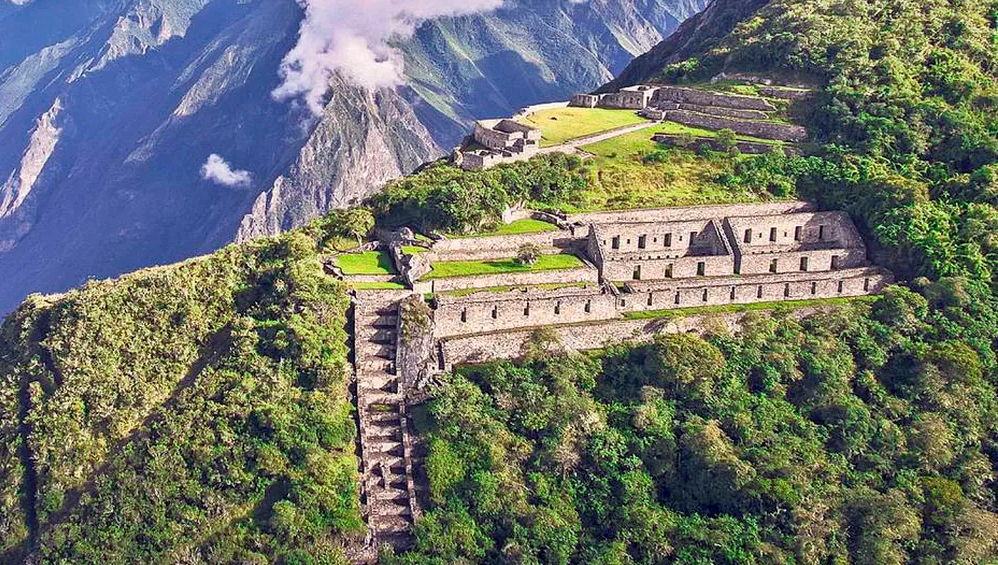
Often referred to as the sister to Machu Picchu, Choquequirao is an Inca city that has many similar features to its more famous sibling. There are ceremonial halls, tombs (that previously held mummies), iconically Incan farming terraces, and of course homes for the people who lived here.
Now, something interesting that sets Choquequirao apart from Machu Picchu and other Incan cities is the llama terraces. These terraces have stone llamas that lead visitors to the central plaza of the citadel. This is the only place that the llama terraces have been noted in the ancient Incan empire.
As the Incas were known to sacrifice llamas as offerings to the gods, often in the central plaza, it is thought that these quartz llamas built into the terraces could have been offered in place after a poor harvest. This is an important note, as a poor harvest would mean there were not many llamas spare to be sacrificed.
This blog will tell you almost everything that you could possibly want to know about Choquequirao (after all, we have to leave a little for the guide, right?). Find links to jump to specific areas of the article below:
- Geography of Choquequirao
- History of Choquequirao
- Layout of Choquequirao
- What it’s like to hike to Choquequirao
- Itinerary options of hiking Choque (3,4,5 days, C+MP)
- Doing it yourself
The Geography of Choquequirao
At 3050m (10,010ft) above sea level, you might be forgiven for thinking that Choquequirao will be a nice hike after the altitude of Rainbow Mountain and Cusco. While it does sit lower than Cusco city (3400m / 11200 ft), its positioning on the brink of the Apurimac canyon offers up an intense hike for those who wish to visit.
The site itself is thought to cover 1,800 hectares, but much of it is still covered in thick jungle thanks to its place in the jungle lowlands. Only 30 – 40% of the site has been excavated. This is just one of the Inca citadels (another being Machu Picchu) that is found in the Vilcabamba mountain range.
The hike to Choquequirao begins in the Apurimac region and crosses through into the Cusco region (in the province of Anta). You will see the change between the regions unfold before your eyes. This is because the Cusco region offered much more help to rural communities affected by the lack of tourism during the pandemic.
This means that those in the Cusco region were able to use the time to grow and expand their hotels and lodgings- or at the very least, survive as they were. Those in the Apurimac region, unfortunately, had to sell a lot of livestock and give up hotels etc in favor of returning to farm the land or join mining communities. (More on this later).
About Choquequirao Ruins (Modern History)
Rumors of Choquequirao swirled for centuries, and it was rediscovered in 1710 by the Spanish explorer Juan Arias Diaz. It was then largely forgotten about until Hiram Bingham (who we will remember as the man who “discovered” Machu Picchu) mapped the site over the course of 4 expeditions between 1910 and 1915. These expeditions were funded by Yale University and the National Geographic.
The site was then thoroughly and repeatedly looted throughout the 1900s. Despite this, the site is so large and so much of it is still covered in thick jungle that it is impossible to say what we might uncover as the excavation efforts progress. Some of the secrets of the Inca Empire might still be discovered if there are treasures left.
Excavation of the site has taken so long because of just how large the site is and how remote it is. Many local people are employed in the effort of clearing the area, but with how remote it is, it is predominantly locals who work here. It’s not the kind of place you can reasonably commute to.
The terraces of Choquequirao were used by locals to grow their crops until the 1980’s, when the Ministry of Culture banned this practice. This also happened at the archeological site of Moray in the Sacred Valley- but it shows you just how well these terraces still work, 500 years after their construction.
In 2002, the first lady at the time, Eliane Karp, was a huge proponent of supporting and securing funding for the excavation and restoration of the citadel. Unfortunately, her and Alejandro Toledo, the president at the time, were arrested for corruption.
This led to the souring of public opinion on the pair, and much of the work they had done while in office being discredited, and their actions being analyzed under a microscope. Rumors began to swirl of Karp flying a helicopter into Choquequirao to steal golden artifacts.
While there is no evidence of this happening, the continued history of Choquequirao suffering from looting, it is no surprise that the rumors cropped up.
In 2011, a cable car was proposed to increase tourism to the area. Currently Choquequirao is only accessible via a multi-day hike, so the cable car was suggested as a way to make the citadel more accessible to the wider public.
The idea was met with mixed opinions, and while it is still officially planned to go ahead, as of 2024, no movement has progressed on the construction or even planning of the cars. We will dive into this in more depth later in the blog.
Despite being just 27 miles away from Machu Picchu, being significantly larger than Machu Picchu’s 10 hectares, and offering more unique archeological features than Machu Picchu (such as the llama’s in the walls), Choquequirao does receive a surprisingly low number of visitors.
While a lot of that can be put down to the difficulty of the hike to get to Choquequirao, Machu Picchu’s place on the seven new wonders of the world list, and general media exposure, Choquequirao is still shockingly undervisited.
To compare, Machu Picchu garners around 1.5 million visitors every year, averaging out at about 2,500 per day. This number used to be even higher, but stricter regulations were implemented after the COVID lockdowns of 2020 in order to preserve the site for generations to come.
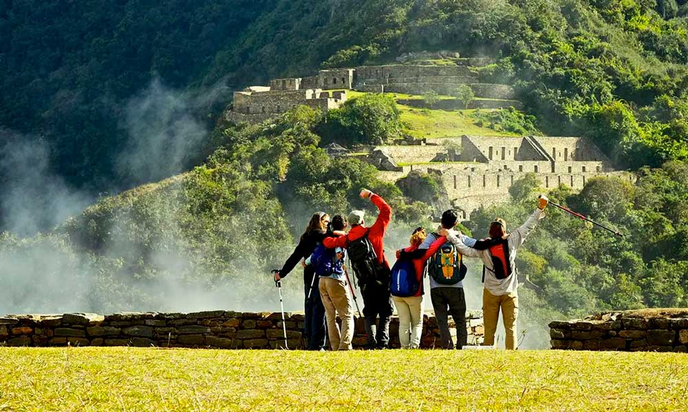
In contrast, Choquequirao receives between 5000 and 8000 visitors per year, averaging out at about 20 people per day. This is already a staggeringly low number but once you consider the comparative sizes of the sites it’s pretty unlikely that you will see anyone from outside of your group while exploring.
If there were only 19 other people in Machu Picchu, you probably wouldn’t even notice them, so in a site the size of Choquequirao? Just make sure you don’t lose track of your guide!
Are Cable Cars a Good Idea?
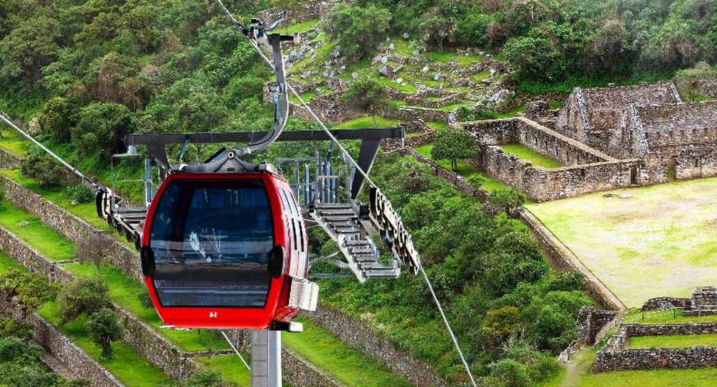
The idea of cable cars going to and from Choquequirao is a very divisive one. There are a lot of people who support the idea, arguing that it would support the local economy and give a boost to the (already thriving) Peruvian tourist sector.
The very idea of the cable cars has created rifts in local communities, polarized archaeologists, and leaves politicians in fierce debate.
Many archaeologists fret over the idea of over tourism similar to how Machu Picchu suffers. It was only 2016 that Machu Picchu was almost placed on UNESCO’s Danger list thanks to the huge number of visitors. But more than just the additional foot traffic the cable car would generate, the actual construction of it may threaten the integrity of the site.
Other archaeologists argue that with better access to the site, the pressure on Machu Picchu would actually be reduced. They say that with the new access there would be better funding in the excavation of the site and a greater motivation to find and excavate other sites like it.
Locals to the area are largely unkeen, especially those who own hotels or restaurants along the trekking route. Many argue that this change would force them to abandon their jobs and homes. The muleteers would also suffer greatly, as equipment and supplies would be sent directly with the cable cars, rendering the job obsolete and the mules a burden on families.
While the cable car may spell disaster for the villages along the trekking route, those who live in the towns above would likely flourish with the increase of tourism. The concern for these towns would be the rapid growth and whether the infrastructure could actually keep up.
Many people argue that instead of spending money on the cable car, the government should be spending money on the upkeep of the trail, the infrastructure along the way, and excavating the site. This would likely increase the flow of tourists in a more sustainable manner, as a gradual flow instead of a sudden tidal wave of tourism.
This would be far more beneficial for the local people, both on the hike and in the towns leading to the trail. It would allow the growth rate to be managed more efficiently instead of potentially harming the surrounding communities and the ruins themselves in the way that the cable car has the potential to threaten.
In my opinion, I believe that the huge majority of people who visit Choquequirao now are interested in the challenge of the trek. I don’t believe that would change completely if the cable car was constructed. After all, people still hike the Inca Trail after the construction of the train tracks.
However, it would doubtless have an irreversible effect on the communities, in some ways good and some ways bad. Regardless, adaptation to the new situation would be necessary.
I think it is relatively unlikely that the opening of the cable car would reduce pressure on Machu Picchu. It may offer a more reasonable alternative in the high season when Machu Picchu tickets are sold out, but it seems unlikely that people wouldn’t just do both or only Machu Picchu. Sure, a few would, but not really enough for it to make a marked difference.
It also seems to me as though the appeal for many people who visit Choquequirao is the fact that there are not many people there. That it’s a chance to explore a Machu Picchu-esque place without facing the huge crowds the sister citadel attracts.
Peru is unique in the way that there are plenty of “on the beaten track” activities, such as Machu Picchu, Rainbow Mountain, and Laguna Humantay. There’s also plenty of “off the beaten track” activities, such as Choquequirao, Palcoyo, and Ausangate 7 Lakes Trek, that can show you similar things without the huge crowds of people.
I think there is a risk of trying to appeal too many things to too many people. Choquequirao appeals to the people who want a challenging trek and to stay away from the crowds. But if the cable car was implemented, who would the site appeal to then?
Ancient History of Choquequirao
Choquequirao was never found by the Spanish, and it lay abandoned for many years before its rediscovery in 1710. Because of this, no one is really sure about what each section is used for, although we do have a pretty good idea for the most part.
There is a well fed rumor that Manco Inca, the leader of the resistance against the Spanish lived here at least in part during his 40 years war, using it as a base for the resistance and leading armies from the citadel.
While Manco Inca would have very likely visited the citadel, it is equally as unlikely that it was built or used for fighting the resistance. The same applies to Machu Picchu.
Although it can be hard to tell exactly what is true owing to the citadels being abandoned at the time of their re-discovery, we can be confident that the construction of both sites was long before Manco Inca and his resistance.
What we do know is that Choquequirao was built in the 15th and 16th centuries, with seemingly two major builds taking place at different times. It’s thought to be likely that Pachacuti initially built Choquequirao and his son Tupac Inca Yupanqui expanded the site upon his inheritance of the empire.
Most historians agree on this, because Choquequirao is found in what they understand to have been Pachacuti’s “estate”. The estate covers areas close to important rivers in the area- Urubamba, Vilcabamba, Apurimac, and more.
It’s widely agreed that Choquequirao probably doubled as an entrance and a checkpoint to the Vilcabamba valley, as well as offering an administrative space and area for political functions. It also would have served as an important link between Cusco and the Amazon.
There are many areas in Choquequirao that are reflective of the way that Cusco (the capital of the Inca Empire) was designed. From areas created to celebrate the Incan sun god of Inti and other sacred entities, to warehouses, areas where artisans would have worked, terraces for people to farm, and more. (Skip to our layout section for more information).
The Layout of Choquequirao
One of the things that helps archaeologists to define an Inca city from other cultures in Peru is the layout and the different buildings that can be found. Some of these iconically defining parts of the city are the royal quarters of the Inca, the Sun Temple, and agricultural terraces. You will have all of these to look forward to in Choquequirao.
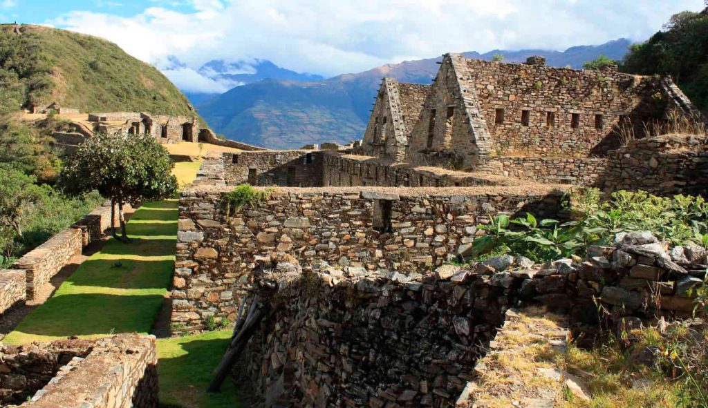
The royal quarters of the Inca is easily identifiable because it boasts better construction, as well as personal plumbing in the form of small canals that lead into what would have been a place to wash.
As you explore the site, you will also see collcas, which were used for storage, a garrison where soldiers lived, private accommodation that it is thought was used for shamans, and a center of administration, among other things.
There are 12 sections in Choquequirao, each with specific uses, but each with common themes. For example, most have agricultural terraces close by and accessible, and storage facilities.
Section 1: The most northern section of Choquequirao is made up of 5 buildings, a plaza and a small temple. Two of the buildings were likely used for storage and the other three are thought to be where the Shaman lived.
Section 2: There are 16 different ceremonial platforms, each with their own canal fed from the main water supply. There are also plenty of storage ports.
Section 3: This is the joining area of the high part of the city and the low part of the city. It is thought that this area acted as the main square, where you will find one and two story buildings and an area used for ceremonies.
Section 4: This is the lower section of the citadel, where you can find a “wall of offerings to the ancestors” in the main building.
Section 5: Perhaps one of the more interesting sections, 5 is a hill that was leveled out by hand, creating an oval platform used for ceremonies.
Section 6: This is a section for the shaman and another ceremonial space.
Section 7: The largest area used for cultivating crops, accessible from the main plaza.
Section 8: You might have heard about the llamas built into the terraces that are so iconic to Choquequirao. This is where you will find the llamas in the walls, often referred to as “llamas del sol”. There are 80 terraces here, divided by canals fed from the main plaza. And I know what you’re thinking: how do we know they’re llamas? They could be alpacas after all. I hear ya.
Well, the figures of the quartz camelids are too slim to be alpacas, but more importantly, the elevation is too low for alpacas to thrive- they tend to do much better in a high altitude. It’s very unlikely that alpacas would have been in Choquequirao at all.
Section 9: The living areas for the common people: workers and families.
Section 10: Also known as paraqtepata, there are 18 canals here that run parallel to the stairs.
Section 11: A large section, with terraces used for cultivation, drinking water fountains, and a living area.
Section 12: The furthest section, to visit section 12 you will need to walk for up to three hours where you can find terraces, ceremonial pools, and stone tools.
What’s the Choquequirao Hike Like?
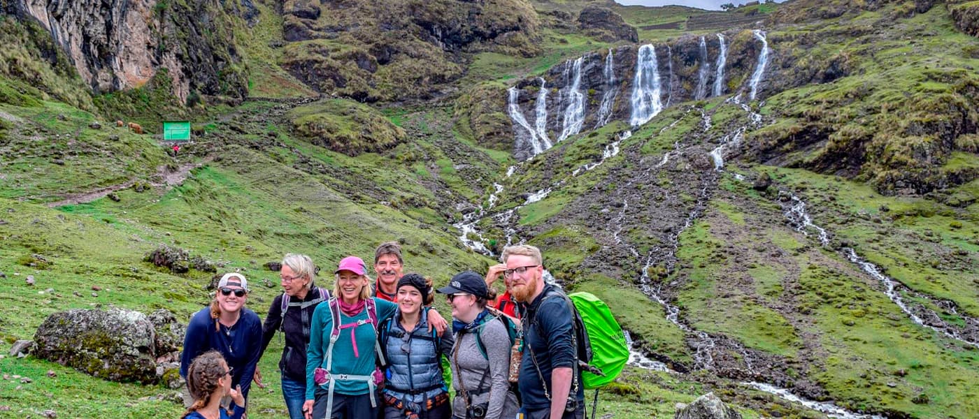
The Choquequirao trek is famously one of the more difficult hikes in the Cusco region. It’s a 39 mile trek, typically done over four or five days- two days to get there, two days to get back and your choice of whether you want a full day to explore the ruins or not. The path is stable but is very rocky with some overgrowth to be expected.
If you have read the details about each section, you likely won’t be surprised when I tell you that the first thing you will see as you approach is terraces. These terraces carry on for almost a mile down the mountain, so while it’s an exciting development in the hike, you still have a while to go before arriving.
The hike starts at the small village of Capuliyoc, which sits at 3033 meters above sea level (9,951 feet). The path then descends all the way down the canyon to the Apurimac river, which sits at 1000m (3,281 ft) above sea level.
Then, it’s right back up the mountain to the ruins, which sit at 3,104 meters (10,184 feet). It’s a tough hike, and once you’ve completed it, it’s right back the same way you’ve come. There are almost no flat sections to look forward to, just harsh uphills and downhills for all the days you are trekking.
The sun in this area can get very hot, so it’s highly recommended to get a good chunk of your trekking done in the early morning, or failing that, the later afternoon (this is less ideal because of the sunset). The sun is very hot between 10am and 2pm, so try to plan around that.
Crossing over the Apurimac river also signifies crossing over from the Apurimac region to the Cusco Region. As mentioned earlier in the blog, look out for the differences in the villages. You’ll see things like solar panels, ovens fit for the village, and so on here. Unfortunately the Apurimac side of the canyon was not privy to this.
Most people taking on the Choquequirao trek will stay in cabins along the way. Other options are carrying your own camping equipment and renting a camping spot (wild camping is not allowed), or renting a tent from one of the villages along the way.
In each village you pass along the way you should be able to find somewhere for a meal and lodging (in the busy season it is recommended that you book this in advance). Be sure to peruse, don’t just jump in the first cafe you see.
Itinerary Options to Hike Choquequirao (3,4,5 days, C+MP)
There are several options when it comes to taking on the Choquequirao trek. The most intense is a three day trek. This should only be attempted by people who are acclimatized, extremely fit, and have a lot of experience in trekking.
It involves descending into the canyon and back up again before camping around three quarters of the way back up. Day two you will finish the summit, explore Choquequirao, and descend back down to your campsite. The final day will see you do the same as day one in reverse.
I do not recommend this trek, even for the most advanced trekkers, as it gives you very little time to enjoy the trek itself, to enjoy the ruins, and very little rest time. It also involves extremely early departure times and forces you to hike through the midday sun. Just… love yourself a little and do something else if you only have three days. Maybe the Huchuy Qosqo trek?
The four day trek to Choquequirao is the minimum number of days I would recommend for travelers to attempt. Typically the four day trek sees the first day descending over the river and climbing up a little.
Please note that while you are at the bottom of the canyon, it is extremely hot- reaching as high as 37°c. It’s because of this most tour groups choose to climb up the mountain a little further before making camp for the first night.
The second day sees a straight climb up the mountain. If your group is fit and fast you may be able to enter the ruins on the second day- just in time for the sunset. You will head back to the nearby village to make camp for your second night.
Day three begins with a guided tour of the ruins, before travelers head back down the mountain. Whether you camp before crossing the river or after is up to your tour leader, and most likely, the pace of the group.
Your fourth day is the final push for the summit and return to Cusco. Choose your tour group carefully and you may get to visit some ruins on your way home as well!
The five day trek to Choquequirao is the same as the four day, but with a whole day to explore the ruins, visit the town, and relax and take your time a little more.
Now, if the Choquequirao trek sounds like it’s right up your street, but just the thought of the up and down of the canyon, then doing it all again the next day has you queasy then you should think about the Choquequirao to Machu Picchu Trek.
This trek starts the same, but after you have reached Choquequirao you continue to hike through the Andes before arriving at Machu Picchu a few days later. It’s not for the faint of heart, but it offers you something wholly unique and another twist on the classic Inca Trail.
Doing the Trek Yourself
It’s perfectly manageable to do the Choquequirao trek yourself, especially if you’re accustomed to high altitude hikes on rough terrain. However, you will need to be cautious as accidents can happen, you should always have a contingency plan in case of emergency.
To get to the trailhead you will either need to take a private taxi, or you can take a shared taxi to Cachora and walk from there. It does add a few miles on, so be sure to factor that into your plans. You should also write down a few words in Quechua.
This deep into the mountains means that Quechua is preferred to Spanish and it’s unlikely that English is spoken at all- though locals might know a few words like “water”, or “bed”, you won’t be having any conversations. Take note of some Quechua words so you’re not caught short at any point.
As with all treks, Doing It Yourself refers to doing it in a group of people you have cultivated. Never hike alone, always make sure you have enough water. And don’t forget your hiking poles. Your knees will thank you.
How Difficult is the Choquequirao Trek?
The Choquequirao trek is famously difficult. Sure, it’s easier if you give yourself 5 days to do it, instead of 3 (please don’t try it in 3 unless you have the option to extend it to 4 if necessary). The trek is basically a 1500m descent made up entirely of switchbacks, to a 1500m ascent, and turning around and doing it all over again.
That kind of exercise is strenuous for everyone. There are ways to make it easier, for example, it’s possible to hire a muleteer to help you carry your things and to stay in guest houses along the way. This minimizes the strenuous nature of the hike but it doesn’t do anything for the hills. Only walking poles and a decent level of fitness will be able to help you there. Make sure you’re well trained, well hydrated, and well acclimatised before attempting this trek.
When to Trek Choquequirao
It is best to trek Choquequirao in the dry season of May to August. The dry weather ensures that the trail is solid and you are less likely to slip. However, there are downsides to trekking at this time.
First and foremost, it gets very cold at night the closer you get to the ruins. A good quality sleeping bag negates this issue, but as the bottom of the canyon stays warm (hot) the extreme changes in temperature can be an issue when it comes to what to pack.
It is also a lot busier during this season. It’s fair to say that even at its peak Choquequirao is not exactly “busy” but if you’re looking for a trek that offers solitude, you may want to look at a different time of the year. That being said, it is probably worthwhile booking your accommodations in advance if you plan to do it yourself.
The shoulder seasons (April, September and October) are also good choices- depending on how much rain has fallen that year. A rainy April can result in slippery and dangerous paths, and you may even risk guest houses being closed before the busy season comes.
November, similarly to April, can be tricky depending on whether the rainy season has started early. The ground can become waterlogged and outright dangerous. In the peak of the rainy season (December to March) the trail is dangerous and any agency that offers travel during this time is irresponsible. Landslides are common and paths can turn into waterfalls.
Even the paths that don’t turn into waterfalls can become very slippery. The closer you get to the ruins the steeper the paths, and the steeper the drops. It’s not worth the risk. If trekking to Choquequirao is so important to you, just travel in the dry season.
Choquequirao is a very special excursion for travelers. Bigger, better preserved, and hardly visited in comparison to its sister Machu Picchu, this citadel is a fantastic opportunity for travelers to get off the beaten track in Peru and do something really unique, different, and still quintessentially Peruvian.
If Choquequirao sounds like your kind of challenge, get in touch with us today to arrange your adventure. Better yet, check out the incredible alternative to the Inca Trail, the Choquequirao to Machu Picchu trek. It truly is a once in a lifetime experience.